Video footage by Jeremy Brown
Snow Surveys
Wet or Dry?
Calculating the water year
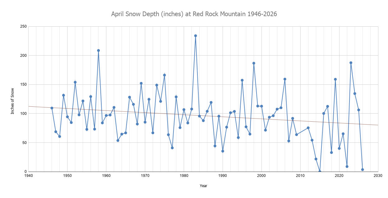
Snow surveys are conducted every January, February, March, and April on three different snow courses located in the Trinity Alps Wilderness. These sites have been measured in exactly the same locations since the 1940s and data from measuring the water content of the snowpack is used to make informed decisions about:
Potential floods
The amount of water diverted to the Central Valley Project
The amount of water released from Trinity Dam
The length of the summer forbearance period
Other decisions that fluctuate depending on whether it is a wet or dry year

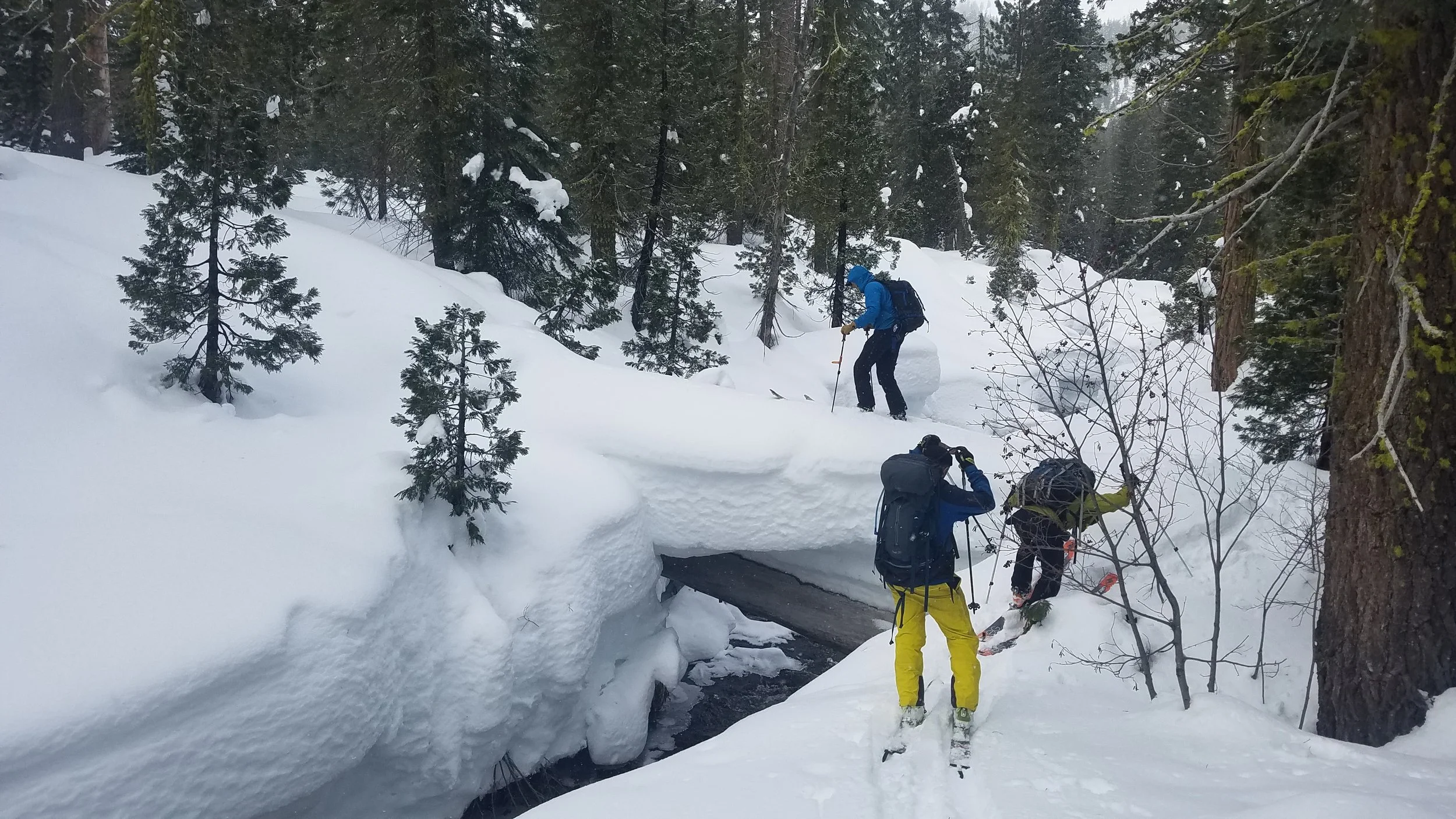
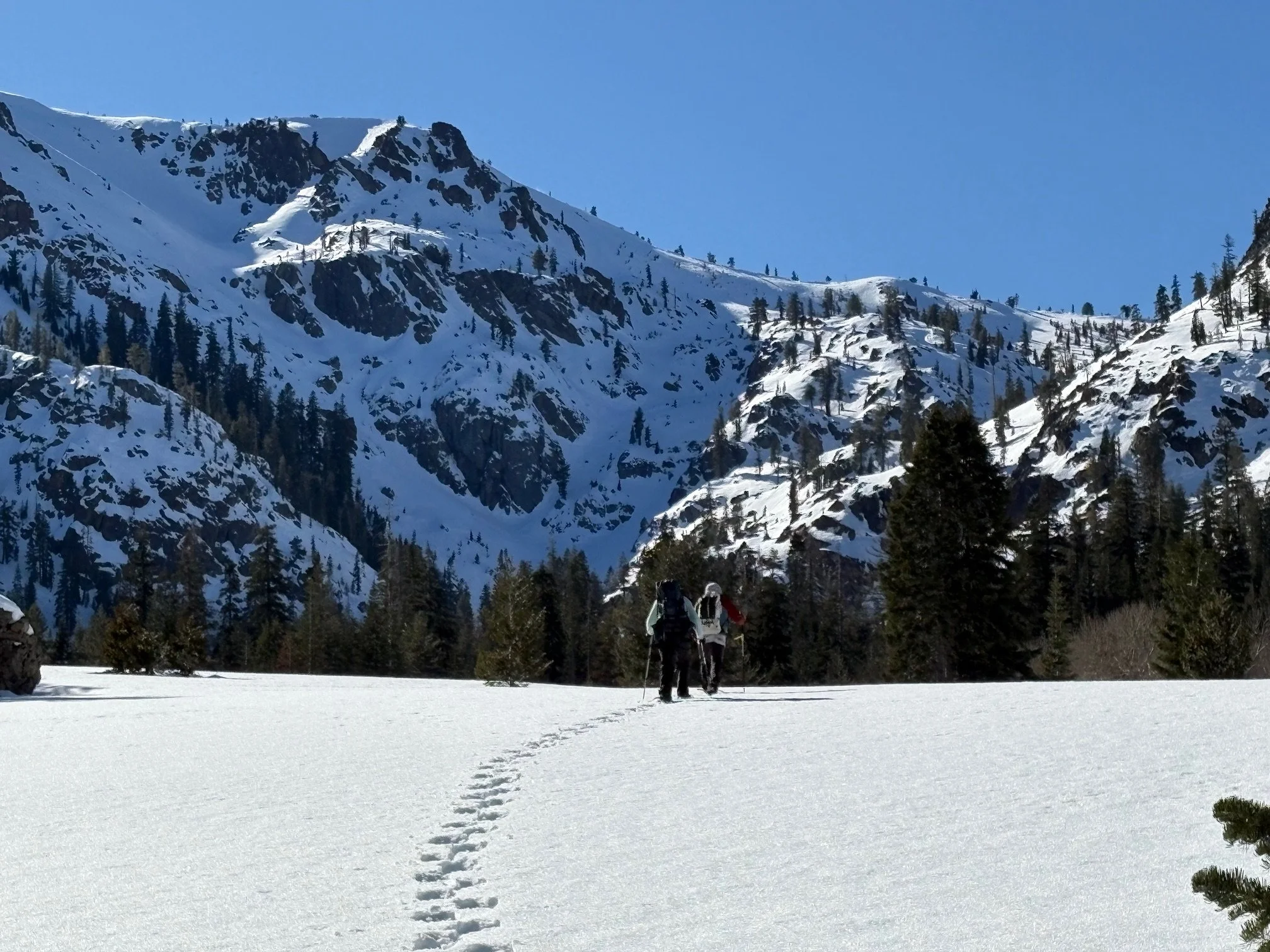
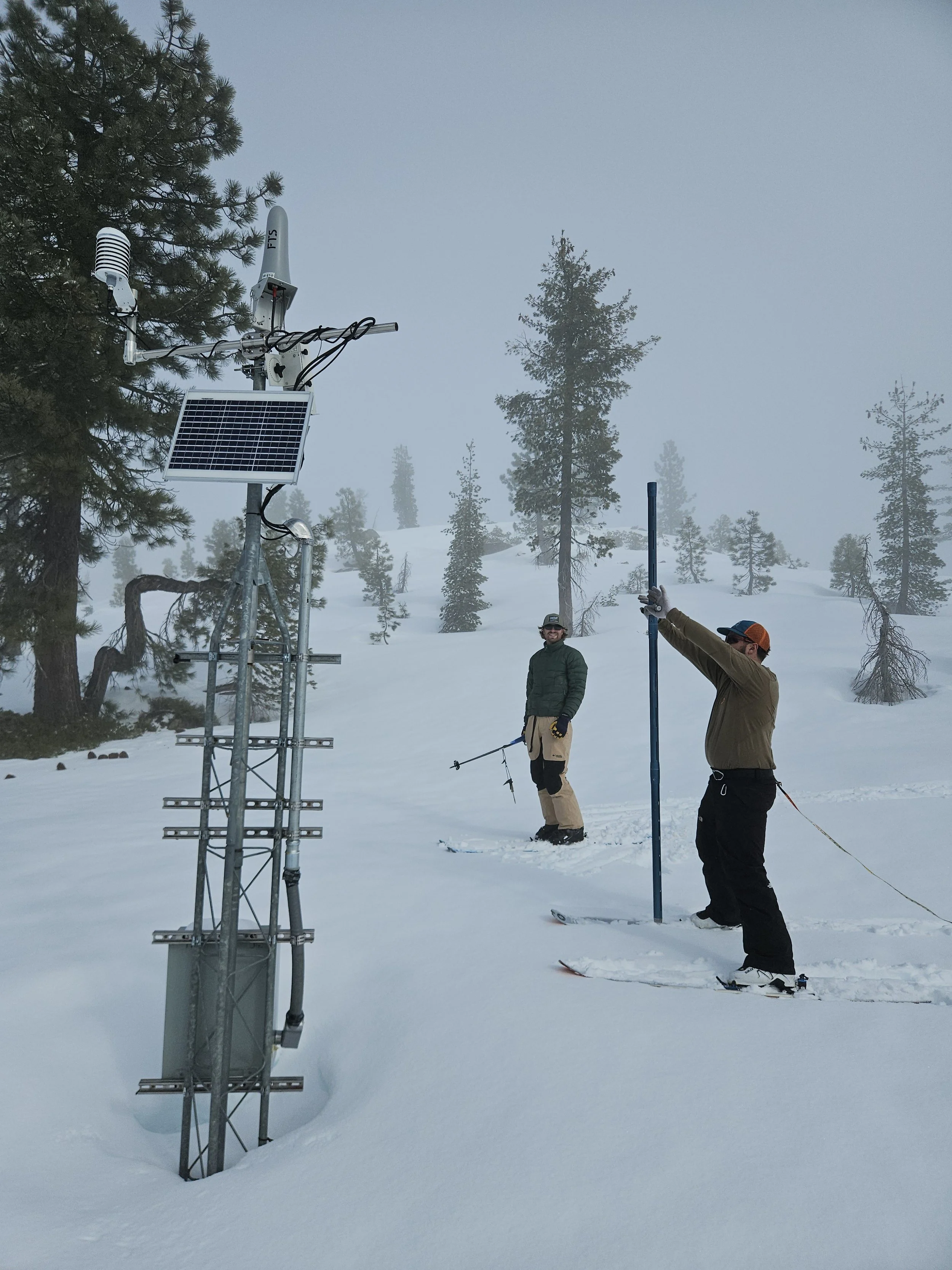
How It Works


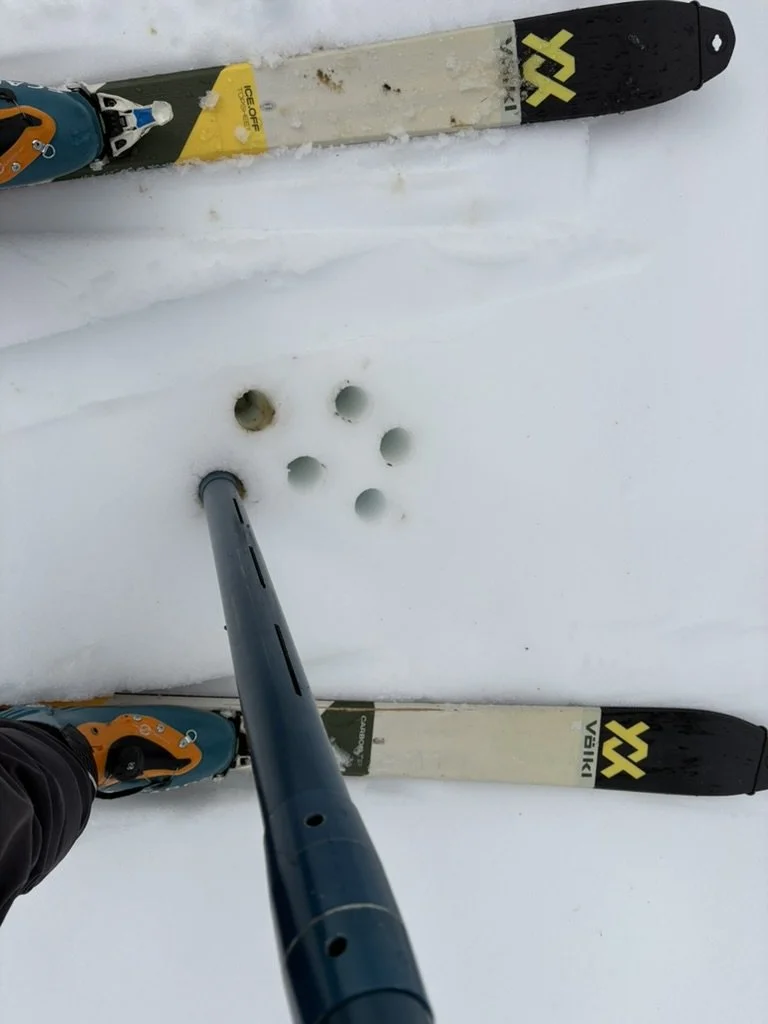
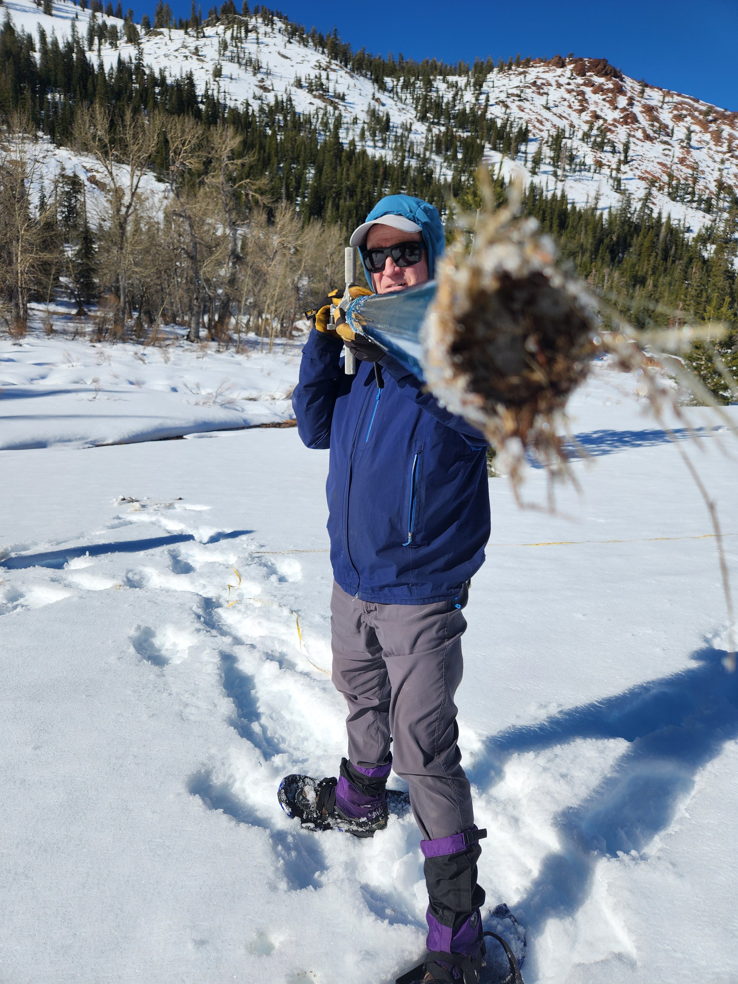
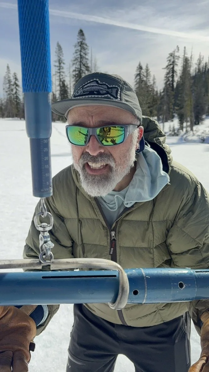
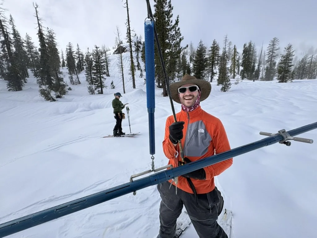
A small team of backcountry skiers and snowboarders travel to each of the survey locations at Shimmy Lake, Red Rock Mountain and Bear Basin in the Trinity Alps Wilderness Area. There, they plunge a specialized snow tube called a Mt. Rose snow sampler into the snowpack 10 times along a designated transect. By measuring the height of the snow and weighing the snow-filled tube, surveyors are able to calculate the “Snow Water Equivalent” (SWE).
Results
With a suite of nearly a dozen survey courses established throughout the Trinity River Watershed, the combination of these valuable data makes it possible for water managers to make informed decisions.
This effort would not be possible without the collaboration of valuable partners and their commitment to obtaining quality measurements.
Science and History Collide
In this video, Watershed Stewardship Program Director and longtime snow surveyor Josh Smith is interviewed our partner, the Trinity River Restoration Program, describing the history of the Watershed Center’s involvement in the Trinity Alps snow surveys.